A myth tells of the 4 elements - fire, water, earth and air - which are embodied by the 4 Albigen (natural elves) and their influence on the forces of nature. Paths around the idyllic village of Grins were dedicated to the 4 Albigen.
At a Glance | |
|---|---|
| Difficulty level: | medium difficulty |
| Elevation loss: | 50 m |
| Walking time / ascent: | 0.5 h |
Information | |
|---|---|
| Walking time / descent: | 0.5 h |
| Starting point: | Grins sports field |
| Finishing point: | Grins sports field |
| Path surface: | Asphalt, forest path, meadow path |
Route type | |
|---|---|
| Circular hike: | Yes |
Fitness & technique | |
|---|---|
| Fitness: | 2 |
| Technical: | 2 |
Getting there | |
|---|---|
| Getting there: |
All the way to the parking lot at the sports field in Grins. |
| Public transport: |
From the Landeck-Zams train station, take Line 6 to Grins (Außerdorf stop). Please check the SCHEDULE. |
| Parking: |
Parking lot near the sports field in Grins |
Best season | |
|---|---|
| Apr: | Yes |
| May: | Yes |
| Jun: | Yes |
| Jul: | Yes |
| Aug: | Yes |
| Sep: | Yes |
| Oct: | Yes |
| City: | Grins |
Route by
Google MapsYou need a bus or taxi?
Bus schedule Here are our recommendations Download TaxiApp Tirol für
Android oder
IOS
Download TaxiApp Tirol für
Android oder
IOS


Recommendable for Luftalb-trail Grins
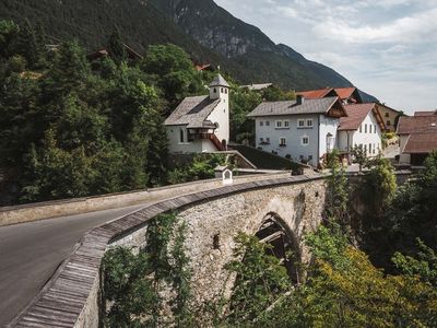
The Floriankapelle is located next to the Roman bridge in Grins
Read more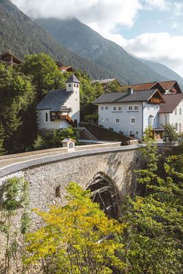

Parking at the sports field
Read more
Beautifully nestled in the sunny hillside terraces of the holiday region Tyrol West lies t…
Read more
The Luftalb is one of the four elements that can be experienced in the myth surrounding th…
Read more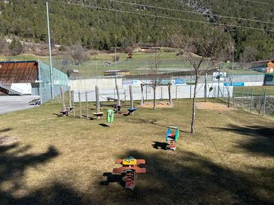
Children's slide, swing, sandpit, ...
Read more
The parish church of Grins is dedicated to St. Nicholas. 1434, the parish church was menti…
Read more
Municipal Office Grins
Read moreMarketingmaßnahmen:
MIT UNTERSTÜTZUNG VON BUND, LAND UND EUROPÄISCHER UNION

