Leisurely hike from the Zammer Alm / Schihütte Zams over to the Jagerhütte and on to Fließ.
Turn the tour around
At a Glance | |
|---|---|
| Difficulty level: | medium difficulty |
| Elevation loss: | 835 m |
Information | |
|---|---|
| Walking time / descent: | 2.75 h |
| Walking time / ascent: | 0.5 h |
| Starting point: | Zammer Alm / Schihütte Zams |
| Finishing point: | Fließ |
| Path surface: | Forstweg, Steig, Asphalt |
Fitness & technique | |
|---|---|
| Fitness: | 3 |
| Technical: | 3 |
Best season | |
|---|---|
| May: | Yes |
| Jun: | Yes |
| Jul: | Yes |
| Aug: | Yes |
| Sep: | Yes |
| Oct: | Yes |
Route by
Google MapsYou need a bus or taxi?
Bus schedule Here are our recommendations Download TaxiApp Tirol für
Android oder
IOS
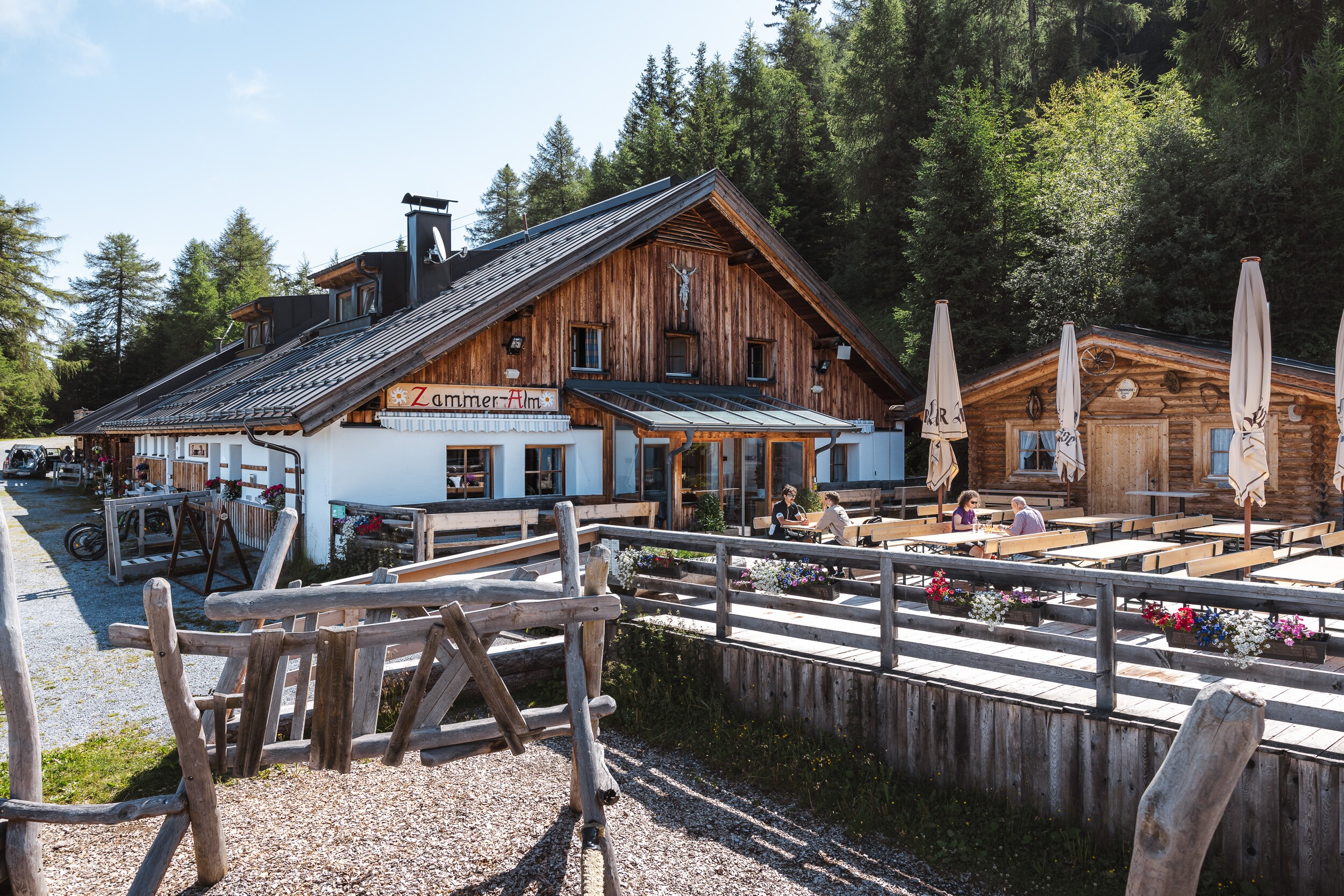

Recommendable for Zammer Alm / Schihütte Zams - Jagerhütte - Fließ
Documentation Center VCA
Located right next to the Fließ Archaeological Museum, the Via Claudia Augusta Read more

Zammer Alm (1.760m)
Hiking – Mountain biking – Skiing – Going on excursions
Read more
Archaeological Museum Fliess
At the Fließ Archaeological Museum, you’ll discover unique treasures from the Bronze Age, …
Read more
Skihütte Zams (1.750m)
Welcome to Skihütte Zams!
Read more
Jagerhütte (1.700m)
Idyllic location at 1700m; above Fließ; insider tip on the Venet southern slope in the Ven…
Read moreMarketingmaßnahmen:
MIT UNTERSTÜTZUNG VON BUND, LAND UND EUROPÄISCHER UNION


Infrastrukturmaßnahmen:

