We use cookies to personalize content and ads, to offer functions for social media and to analyze access to our website. If you give us your consent, we will provide information on your use of our website to our partners for social media, advertising and analyzes. Our partners may carry this information together with other data that they have provided them or who have collected them as part of their use of services. You can revoke your consent at any time.
Read more...
Necessary cookies
Statistics
Marketing
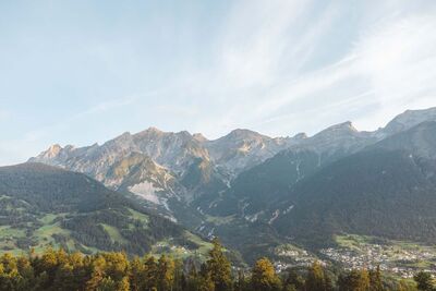
Fotopunkt Lechtaler Alpen
Abschnitt_2
Looking north, the view sweeps across the center of Tobadill toward the Lechtal Alps, dominated by the Parseierstock range, which—starting from the far west—includes the Dawinkopf (2,896 m), then the Parseierspitze itself (3,036 m), and the Gatschkopf (2,945 m) to the east. At the foot of the Gatschkopf, at an elevation of 2,298 m, lies the exposed Augsburger Hütte, which can be reached from the village of Grins below.
 Download TaxiApp Tirol für
Android oder
IOS


